Greenville, South Carolina, September 22, 2025
News Summary
The National Weather Service has issued a severe thunderstorm alert for Greenville and Anderson counties. With wind gusts expected up to 40 mph and pea-sized hail, residents are advised to take precautions against flooding and falling debris. Areas such as Greenville Downtown, Powdersville, and Mauldin may experience the worst impacts. Motorists are cautioned to steer clear of flooded roadways and stay updated on weather conditions as thunderstorms approach. The alert is valid until 4 p.m., underscoring the urgency for safety measures.
Greenville, South Carolina Faces Severe Thunderstorm Alert
The National Weather Service (NWS) Greenville-Spartanburg SC has issued a severe thunderstorm alert at 3:19 p.m. on Saturday for Anderson and Greenville counties. The alert is valid until 4 p.m. and anticipates strong thunderstorms capable of producing wind gusts of up to 40 mph along with pea-sized hail measuring 0.25 inches.
According to Doppler radar, a strong thunderstorm was tracked at 3:18 p.m. just 6 miles southwest of Greenville Downtown, near Powdersville, and is currently moving south at 10 mph. The impact of these storms is expected to result in gusty winds that could knock down tree limbs and move unsecured objects. Minor damage to outdoor items from hail is also a potential concern.
Areas expected to be affected by these storms include Greenville Downtown, Greenville Eastside, West Greenville, Welcome, Powdersville, Piedmont, Williamston, West Pelzer, Donaldson Center, and Mauldin. The NWS has advised residents to be cautious of torrential rainfall, which could lead to localized flooding. Motorists are cautioned to avoid driving through flooded roadways and ensure their vehicles are positioned safely from potential hazards.
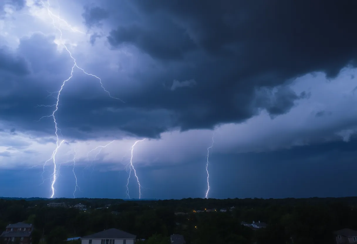
Lightning and Hydroplaning Risks
The risk of lightning significantly increases as thunderstorms approach, peaking when the storms are overhead before declining as they move away. Lightning strikes the United States approximately 25 million times annually, primarily in summer, and causes around 20 fatalities each year. Additionally, hydroplaning, which is the uncontrollable sliding on wet roads due to water building up under tires faster than it can be displaced, poses a danger during these weather conditions.
Recent Weather Patterns
This alert follows a prior severe thunderstorm warning issued on June 17, which impacted multiple counties with reported wind gusts of up to 60 mph. Locations affected during that period included Elbert, Hart, Henderson, Polk, Transylvania, Abbeville, Anderson, Greenville, Oconee, and Pickens counties. Significant concerns during both warning periods included damaging winds, hail greater than 0.75 inches, and flooding.
A tragic incident on June 30 resulted in the death of a 79-year-old woman when a tree fell on her car during a severe thunderstorm in Greenville, highlighting the potential dangers associated with such weather phenomena.
Safety Recommendations
Residents are encouraged to monitor weather updates closely and take precautions during severe weather, including securing outdoor objects and avoiding flooded areas. Awareness and proactive measures can help prevent accidents and injuries during thunderstorms.
Key Features of the Severe Thunderstorm Alert
| Feature | Description |
|---|---|
| Issued By | National Weather Service (NWS) Greenville-Spartanburg SC |
| Time Issued | 3:19 p.m. Saturday |
| Expiration Time | 4 p.m. |
| Wind Gusts | Up to 40 mph |
| Hail Size | Pea-sized, 0.25 inches |
| Affected Areas | Greenville Downtown, Powdersville, Mauldin, among others |
| Flood Risk | Localized flooding expected |
FAQ
What is the duration of the severe thunderstorm alert?
The alert is valid until 4 p.m.
What areas are affected by the thunderstorm?
Impacted locations include Greenville Downtown, Greenville Eastside, West Greenville, Welcome, Powdersville, Piedmont, Williamston, West Pelzer, Donaldson Center, and Mauldin.
What is the expected wind gust speed?
The storms are expected to bring wind gusts of up to 40 mph.
What happens if you drive through flooded roadways?
The NWS advises not to drive through flooded roadways, as it can be dangerous.
What historical incident emphasizes thunderstorm dangers?
A tragic incident on June 30 involved a 79-year-old woman killed when a tree fell on her car during a severe thunderstorm in Greenville.
Deeper Dive: News & Info About This Topic
HERE Resources
Newborn Safe Haven Surrendered in Greenville County
Search Intensifies for Missing Teen in Greenville
Investigation Launched After Body Found in Easley Pond
Clemson University Addresses Backlash Over Faculty Comments
Grand Re-Opening of Construction Zone at Children’s Museum
Georgia Tech and Vanderbilt Secure AP Top 25 Rankings
Southside High School Teacher Dismissed Over Controversial Post
Greenville County Teacher Dismissed for Inappropriate Post
Greenville Honors Pastor Matthew D. Long, Jr. for Community Impact
Greenville’s Economy Boosted by Tourism Growth
Additional Resources
- Greenville Online
- Wikipedia: Severe Thunderstorm
- Delaware Online
- Google Search: Thunderstorm Safety
- Herald Online
- Google Scholar: Thunderstorm Risk
- Fox Carolina
- Encyclopedia Britannica: Thunderstorm