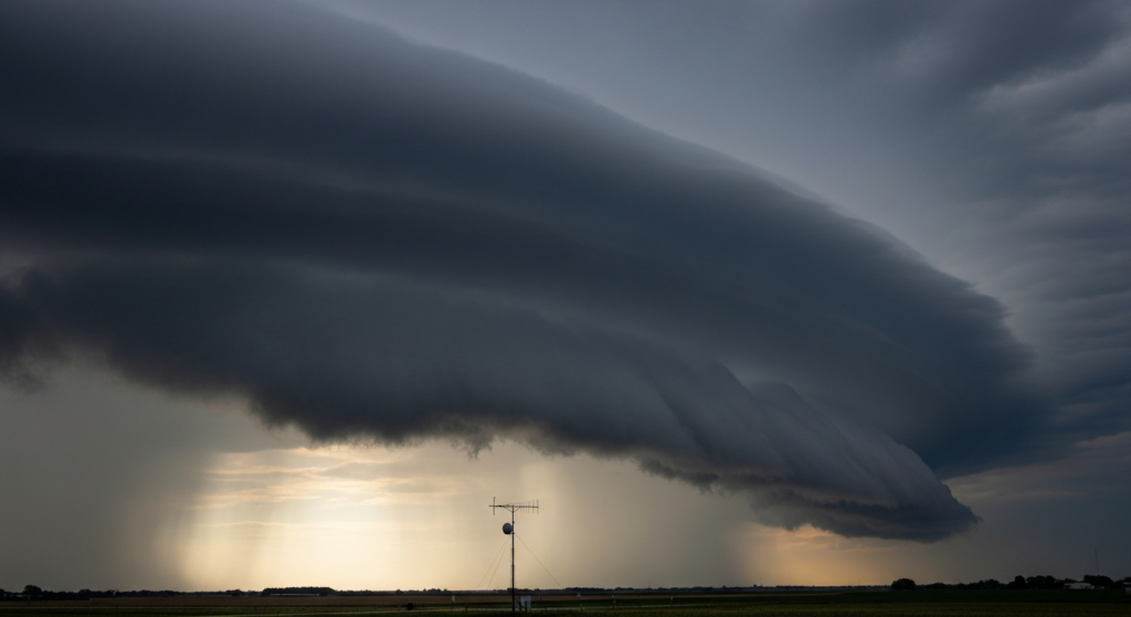
Severe thunderstorms are anticipated to develop across a broad swath of the northern Plains and extend into portions of the Upper Midwest on Sunday, according to independent weather-risk summaries. These analyses highlight the potential for significant weather events that could impact outdoor activities and travel plans for residents in the affected regions.
The primary hazards identified in these non-federal forecasts are large hail and damaging straight-line winds. While the risk of tornadoes is present, it is considered lower than the likelihood of hail and wind damage. The timing and precise location of the most severe weather will depend on the evolution of atmospheric conditions throughout the day.
Forecasters are closely monitoring the development of a weather system expected to interact with atmospheric instability. This combination could fuel the development of strong thunderstorms capable of producing hail of significant size and winds strong enough to cause widespread damage to property and trees. Residents in the forecast area are advised to stay informed about updated weather information and to have a plan in place to seek shelter if severe weather threatens.
The potential for severe weather underscores the importance of preparedness for those with outdoor plans. Events such as local festivals, sporting activities, or simply leisure time spent outdoors could be subject to cancellation or disruption. Travelers in or through the affected areas should also be aware of potential delays or hazardous driving conditions due to severe weather, including reduced visibility from heavy rain and the risk of wind-blown debris.
While the most significant risk is concentrated in the northern Plains and Upper Midwest, the broader weather patterns could influence conditions in adjacent regions. The dynamic nature of severe weather means that forecasts can change, and continuous monitoring of weather updates is recommended. The focus remains on the potential for damaging winds and large hail, which can pose immediate threats to safety and property.
This forecast serves as a reminder of the unpredictable nature of weather systems and the need for vigilance. The information provided by independent weather-risk summaries aims to offer advance warning to allow individuals and communities to make informed decisions regarding their safety and activities. The potential for severe weather on Sunday necessitates a cautious approach for all outdoor endeavors in the projected impact zones.
Why it matters in Greenville:
While the immediate severe weather threat is forecast for the northern Plains and Upper Midwest, understanding these broader weather patterns is crucial for regional preparedness. Events like these can influence national weather models and potentially affect air travel routes that connect Greenville to other parts of the country. Furthermore, the preparedness measures recommended for areas facing severe thunderstorms—such as staying informed and having contingency plans—are universally applicable. For residents in Greenville, this serves as a general reminder about the importance of weather awareness, particularly as summer weather can bring its own set of localized challenges, from intense heat to sudden downpours. Maintaining awareness of weather forecasts, regardless of their immediate proximity, contributes to a more resilient community. The potential for disruptions in other regions also highlights the interconnectedness of national weather systems and their indirect impact on local planning and travel. Greenville communities through travel and supply chains.